Tag Archives: Yorkshire Dales

Ingleborough Cave

Time for my second post of my Yorkshire Dales trip.  As I alluded to in my last post about Malham Cove, one of our goals for the trip was to visit Gaping Gill.  Sadly this wasn’t open due to a technical fault, so instead we visited the nearby Ingleborough Cave.  One thing to note is that this isn’t a potholer’s cave, it’s a show cave.  My own potholing experience amounts to a trip down an abandoned slate mine in Wales…anything more adventurous and I’m likely to become a troglodyte.  Oh and apologizes for the quality of some of the images, it’s a little hard to take photos in the dark cave light.

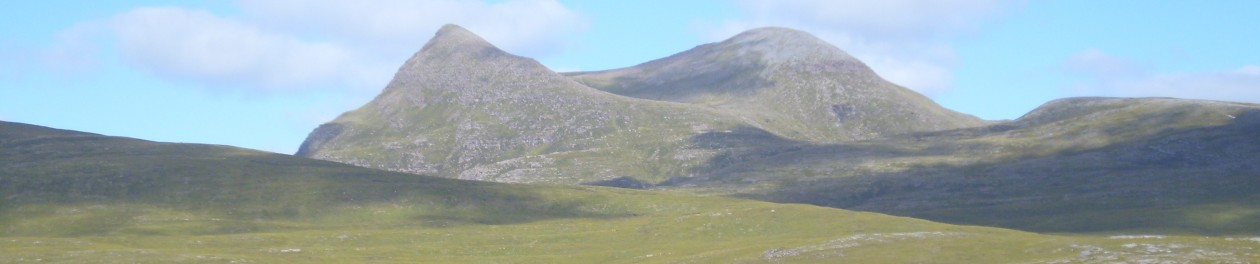
Location & Access: To get to the cave, park in the village of Clapham, just off the A65.  The cave is about 2km north of the village located around 54*08’05” North, 2*22’38” West.  To get to the cave you follow the path north out of the village.  The path is wide and in very good condition (rather bizarrely a toll path too so bring some pennies), so you shouldn’t have to much trouble walking to the cave.  Sadly there is no closer public vehicular access, so you’ll have to walk.  Being a show cave, Ingleborough Cave is geared towards families, the access is good and the cave floor has been given a layer of concrete to allow disabled usage.  This doesn’t spoil the aesthetic to much.  The tour of the cave does involve a guide and will cost money some bring some cash.

Geology:  The cave is in the bedding planes of the Garsdale Limestone Formation (331-339Ma) and like Malham Cove it was once a shallow, carbonate sea.  In some places you can actually see the fossils of the coral and other organisms.

IMG_2212

The cave was carved out by river water and was partially filled in by glacial till, some of which has been removed to open up the cave.  Not all of it has been and the full extent of the cave is not yet know.

IMG_2206Excavations are still on going and have brought up the remains of a woolly rhinoceros tooth, from the Devensian Glaciation (about 10,000 years ago).

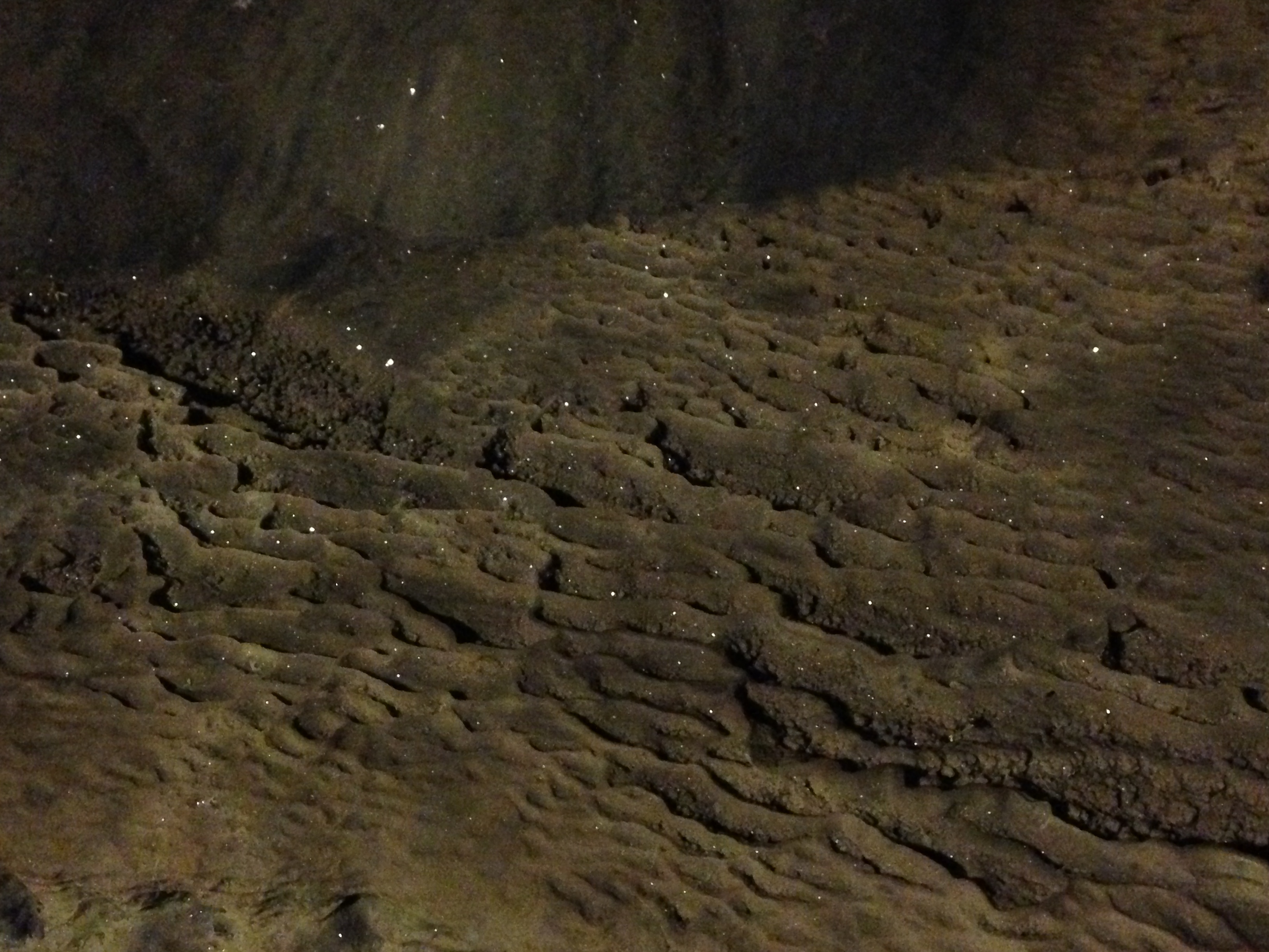
There are several underwater pools still in the cave, and the cave itself is regularly flooded when there are heavy thunderstorms.  When the cave was first explored in 1837 it was flooded, the water held back by a calcite dam.  This was blasted to drain the lake at the time, but parts of another calcite dam can be seen.

IMG_2231

The historic level of the cave water is marked out at a level where you find the cave coral deposits below the waterline and the flowstone above.

IMG_2224

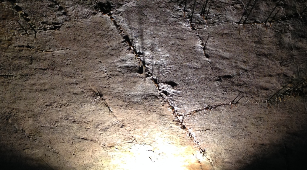
There are plenty of stalactites and stalagmites in the cave of various sizes, the biggest of which is The Sword of Damocles and is a few metres long.

IMG_2183

Along with these you will see plenty of helictites and speleogens as well as other cave formations.  A look at the feature image to this post shows how the natural cleavage & faults in the rock are exploited by the water and form the basis of the stalactites.

IMG_2239

Overall this a good cave to visit, especially if you are not an experienced caver, and a good alternative to Gaping Gill if the winch is broken.  It’s a show-cave, but a good one.  There are plenty of formations to see, and if you are in the area I would recommend visiting the cave if you have a spare couple of hours.  They also have a good website explaining the cave and showing more pictures at www.ingleboroughcave.co.uk.

Reference: The Geology of Britain; An Introduction by Peter Toghill (2006), Geology (2nd Edition) by Stanley Chernicoff (1999), http://www.ingleboroughcave.co.uk and the tour guide on the day.

Malham Cove

This week I have had the opportunity to visit the fantastic Yorkshire Dales in the north of England.  I got a chance to visit a few sites.  Much to our disappointment we weren’t able to get down Gaping Gill due to a technical fault with the winch, so we instead saw a few other places and I’d thought I’d share them with you.  The first is epic Malham Cove.

Location & Access:  Malham Cove is located in the south half of the Yorkshire Dales National Park at approximately 54*21’41” North, 2*09’28” West, about 1km from Malham village.  You can park a car in the village (itself a wonderful place to see) and walk up the road to the cove.  The road is good and there is a slight incline.  just above the village is a clearly marked, good quality path to the cove…and to be honest you really can’t miss it from there.  People with mobility issues shouldn’t have much trouble walking along the path, though the road can be a bit of a trek.  Warning!  The main path goes through a field of cows so beware of bovines.

IMG_2301

Geology:  The underlying rock is Carboniferous Limestone from the Garsdale and Danny Bridge Formations (331-339Ma), and represents a depositional environment of a shallow carbonate sea, full of corals and shell creatures.  That was then, what about now?  Like much of northern England the current landscape is largely the result of the various glaciations of the past, in particular the Devensian glaciation which ended about 10,000 years ago.  Malham Cove is thought to have been formed slightly earlier (about 12,000 years ago) as the ice retreated north.  The melting glaciers produced a large amount of run-off, and with the ground still being semi-frozen permafrost the water eroded the limestone instead of infiltrating into and dissolving it as happens now.

This led to the wonderful dry water seen today.  The semi-circular Malham Cove is about 80m high and about 300m across.  This makes it higher, but only about half as wide as the horse-shoe at Niagara Falls.  This gives you an idea of what the falls would have looked like in full flow 12,000 years ago.

IMG_2312

IMG_2331You can see the bedding planes in the limestone and if you look at the right of the image above you should be able to see two climbers ascending the cliff face (right of the centre tree, about half way up the picture in yellow).  This gives you an idea of the scale of the place.  At the base of the cliff is a small stream, exiting from one of the many underground river systems in the Dales.

IMG_2316

Although you should always be careful approaching a cliff face I would recommend getting as near to the base as possible and looking up…it’s fantastic.  I tried to take a few pictures, but none of them do it justice, so you’ll just have to go there yourself.  Stand in the centre of the horse-shoe, close to the base and look up, it’s this wonderful bowl shape.

Above the falls is another wonder of the Dales; the limestone pavement.

IMG_2288

These are a special feature, common to the Dales, but rare in the rest of the UK.  The flat surface is a bedding plane in the limestone, exposed by glacial & periglacial erosion.  This produces the flat ‘paving slabs’ called clints.  The gaps in between are the result of rain water getting into cracks in the limestone and dissolving some of it.  These gaps are called grykes.  Walking along a limestone pavement is quite an experience, but be warned some of the clints are wobbly and the grykes can be wide and deep.  Some of them may even be filled in with a thin layer of soil & grass so watch your step.

Other Stuff: You’ve got glacial valleys & erosion, caves, underwater rivers & springs, a dry waterfall higher than Niagara and limestone pavements…what more could you want? OK well aside from the geology it is also a great pace to catch a glimpse of one of my favourite birds; the Peregrine Falcon.  These nest up on the cliff face your chances of seeing one is good.

To sum up, if you are ever in the north of England Malham Cove is worth the visit.  The pictures I’ve posted really don’t do it justice, you’ll have to go see it for yourself.  Stay geogeeky as I’ve got more from the Dales that I’ll post soon.  Enjoy.

Reference: The Geology of Britain; An Introduction by Peter Toghill (2006), Geology (2nd Edition) by Stanley Chernicoff (1999).